
Oregon City ZIP Coverage
Only one ZIP code is verified for address points inside Oregon City: 97045. The City Address Points layer audit completed on August 31, 2026 found 17,354 points inside the city limits with ZIP5 97045, and none with another ZIP5. That is a local GIS finding, not a claim that every address using 97045 is inside the city. Postal routing can extend beyond the municipal boundary, so an Oregon City ZIP code directory needs a city-limit check as well as a delivery check.
| ZIP | Areas Covered | Post Office | Notes |
|---|---|---|---|
| 97045 | Oregon City in-city address points | Oregon City Post Office, 19300 Molalla Ave. | The City GIS audit found 17,354 in-city points tagged 97045 on August 31, 2026. USPS verifies a particular delivery address. |
| 97068 | Adjacent West Linn postal context | Not verified as Oregon City delivery coverage | An adjacent routing caution only. Do not treat it as an Oregon City ZIP without a specific USPS and address result. |
97068 appears in regional ZIP-boundary context near Oregon City, but the research did not verify it as an Oregon City delivery ZIP. No other in-city ZIP, PO-box ZIP, unique ZIP, split, or realignment has been verified for this directory. That restraint matters when a ZIP search is used to narrow an address question.
Oregon City Address-Point Audit
The City maintains address points inside its limits as addresses are added, changed, or removed. Clackamas County maintains surrounding points on a quarterly cycle. That difference helps explain why a nearby postal place name may appear close to Oregon City on a regional map while the City layer reports a different municipal result. The audit is time-specific evidence about the City’s own points, not a substitute for a delivery decision by USPS.
Oregon City’s public address-point layer is the source behind the local ZIP and in-city fields used for the audit.
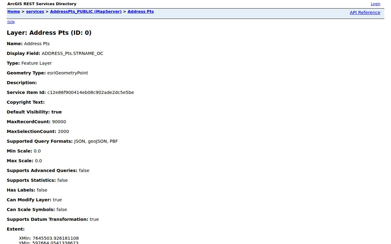
Use the layer as a local geography clue, then confirm an individual mailing address with the postal service and the property’s jurisdiction with CMap.
Note: A ZIP shown near a city edge is not, by itself, proof that the parcel is inside Oregon City.
Verify Oregon City ZIP Delivery
Start with the full mailing address in the USPS delivery lookup. USPS is the authoritative route for confirming the ZIP assigned to a specific delivery address. Next, enter the physical address in CMap to see the property and its City or Jurisdiction context. The two checks answer different questions. USPS handles delivery routing, while CMap supplies parcel and government-geography context.
- Enter the full delivery address in USPS and record the returned ZIP exactly.
- Search the same physical address in CMap, using its Address mode if the address is known.
- Review the Jurisdiction context and parcel placement rather than relying on a postal place name.
- Use the taxlot, parcel, or normalized address only for the specific county or city record that accepts it.
Clackamas County’s CMap explanation describes the viewer’s parcel, building, value, district, map, and jurisdiction context, while also stating that it does not publish owner names online.
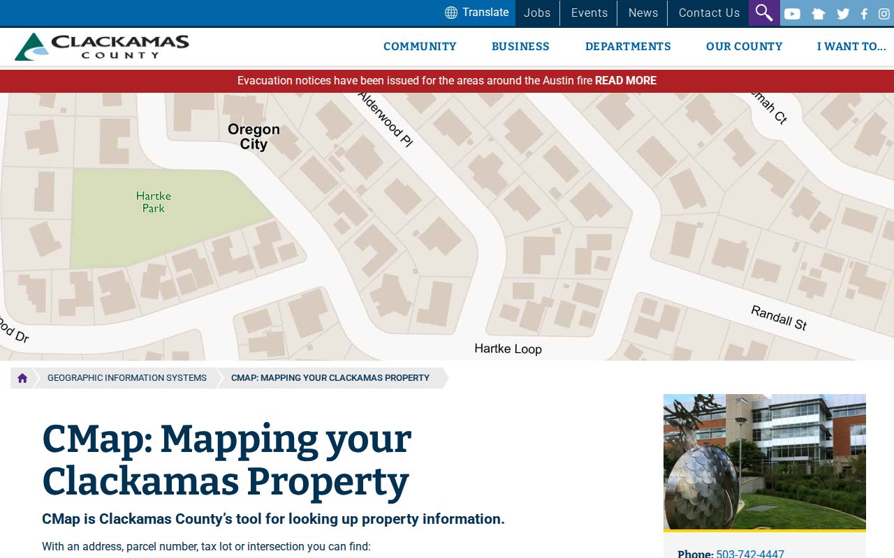
A CMap result can place a property in the right public-record system, but it does not establish delivery, ownership, or who lives there.
Oregon City Property Search Fields
Clackamas County’s public property-account tools are address-led. The Tax History service accepts an Address or Account Number. CMap accepts Address, City, Parcel Number, Street Intersection, or Taxlot Number, but the research did not verify a CMap ZIP filter. AscendWeb provides a public property-account and address interface with optional City, State, and ZIP address refiners. Those refiners help narrow an already identified address; they are not a citywide owner or resident browse tool.
| Address | Use the physical address to identify a property account or location. |
|---|---|
| City | Optional AscendWeb address refiner; CMap also has a City search mode. |
| State | Optional AscendWeb address refiner when an address query needs geographic context. |
| ZIP | Optional AscendWeb address refiner, not a verified ZIP-wide resident listing. |
| Account Number | Tax History alternative when the county account is already known. |
Clackamas AscendWeb is the documented property-account route with those address refiners and without a public owner-name search.
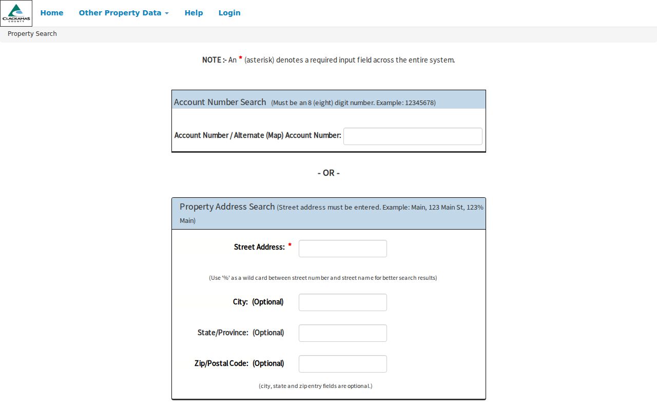
When the ZIP field returns no useful result, keep the confirmed street address and use the county’s available address, account, or parcel route instead of expanding the search into a presumed ZIP roster.
Oregon City Postal City Limits
A 97045 mailing address can be outside incorporated Oregon City, and the city line remains the deciding geography for city-created records. CMap is the local check for City or Jurisdiction context. A ZIP boundary is a postal-delivery construct, not a municipal boundary or a parcel survey. The 97068 row above is deliberately only an adjacent caution because the research did not identify a specific Oregon City address served by 97068.
Boundary check. Verify delivery through USPS, then verify the physical property in CMap before treating a ZIP as Oregon City geography.
For a narrow street-level record question after the ZIP and jurisdiction are settled, the Oregon City street directory follows the address and parcel route in more detail.
Oregon City Address Identifiers
Postal information should stay separate from the identifiers used by mapping, permit, tax, and recording systems. A precise Oregon City ZIP helps with mail, but it cannot replace a parcel identifier or a recorded legal description. Keeping the terms apart makes an old address easier to match to a current map and prevents a custodian-released mailing address from being treated as proof of physical location.
- ZIP and ZIP+4
- A ZIP directs mail to a delivery area. ZIP+4 adds a narrower delivery segment, but neither one defines a city limit or a parcel boundary.
- Situs or physical address
- The location of the property, used by CMap and the City permit route. It can differ from a mailing contact address.
- Mailing address
- A delivery contact that may appear in a releasable tax or filing record. It is not automatically the property location or an occupancy record.
- Legal description
- The recorded parcel identifier, such as metes and bounds, a subdivision lot and block, or a document reference. It persists when street numbers are unclear.
- Carrier route
- A Postal Service delivery grouping. It is not a city boundary and should not be used as a resident list.
Oregon City Postal Geography
Oregon City developed across low, middle, and upper Willamette River terraces. The early Main Street and falls area, later bluff development, upper-terrace growth, and the Canemah area all add historic place context that a contemporary ZIP label leaves out. City subdivision maps extend from 1850 to the present, while CMap adds city, urban-growth-boundary, and district layers. Those geographic tools are often more useful than a postal label when an address appears in an older record.
Canemah is now within the city limits, yet its historic identity can still matter when comparing a newspaper, plat, or record description with a current address. Use the dated source and the mapped jurisdiction together. The research found no official citywide ZIP realignment chronology, so no such history should be assumed.
Oregon City Property Record Context
The county’s Tax History tool uses an address or account number for value history. It does not publish owner names online. Oregon City’s Permit Record Search is also address-oriented and reaches final or closed permits back through 2002, with current and open status plus inspection context. The city’s published permit material does not verify a ZIP-wide search control, so a ZIP should first be converted into a confirmed address before either record path is used.
Clackamas County’s tax-statement lookup provides a tax-year and parcel or address-selection route for a specific property.
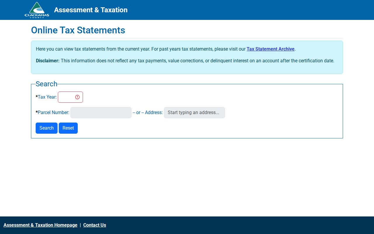
Property context can date an assessment or permit event, but it does not turn a ZIP into a list of people at that address.
Note: A missing ZIP filter is a limit of the documented tool, not a reason to infer a result from a neighboring postal area.
Oregon City Delivery Verification Limits
The USPS city and state ZIP lookup is the delivery-verification starting point for a particular address. It should not be read as a public browse list for every person in a ZIP. The research also did not establish a ZIP-based voter browser, a citywide ZIP resident roll, or a verified ZIP filter in the City permit search. Oregon My Vote is designed for an individual’s registration-status and update path, not a by-ZIP resident search.
When a physical address is known, keep the question narrow: delivery ZIP through USPS, jurisdiction and parcel context through CMap, then the appropriate city or county record. That sequence is more accurate than claiming a ZIP alone identifies Oregon City residents.
USPS’s Oregon City verification screen is the source captured for the individual-delivery step.
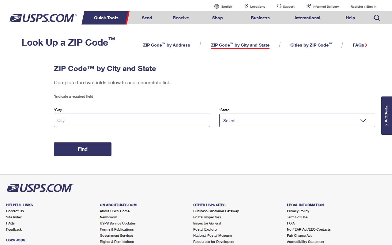
Postal confirmation is strongest when the full address is entered, then kept alongside the jurisdiction result and the date of the record being reviewed.
Oregon City ZIP Record Route
Once an Oregon City ZIP and address have been verified, select the record keeper by question. CMap supplies parcel and geographic context. Assessment and Taxation handles owner-information requests through its phone, email, counter, or public-record channel after a parcel is identified. The County Clerk Recording Division is the source for recorded property instruments and legal-description history. City permit records can add a later construction or inspection chronology. Each source has a distinct role, and none is a comprehensive resident directory.
This approach also preserves the difference between postal delivery, property interest, and actual occupancy. It is a practical safeguard for family-history, estate, personal-safety, and civic-curiosity research, and it avoids turning partial public records into claims about living people.